
The Future of Urban Forestry is Here: How GIS and LiDAR Are Transforming Tree Management
Urban forestry is experiencing a technological revolution. While traditional methods relied on clipboards and measuring tapes, today’s arborists and landscape architects have access to sophisticated digital tools that solve real problems in urban forest management.
Geographic Information Systems (GIS) and Light Detection and Ranging (LiDAR) technologies are leading this transformation, offering practical solutions to everyday challenges in urban tree care.
Understanding the Technology
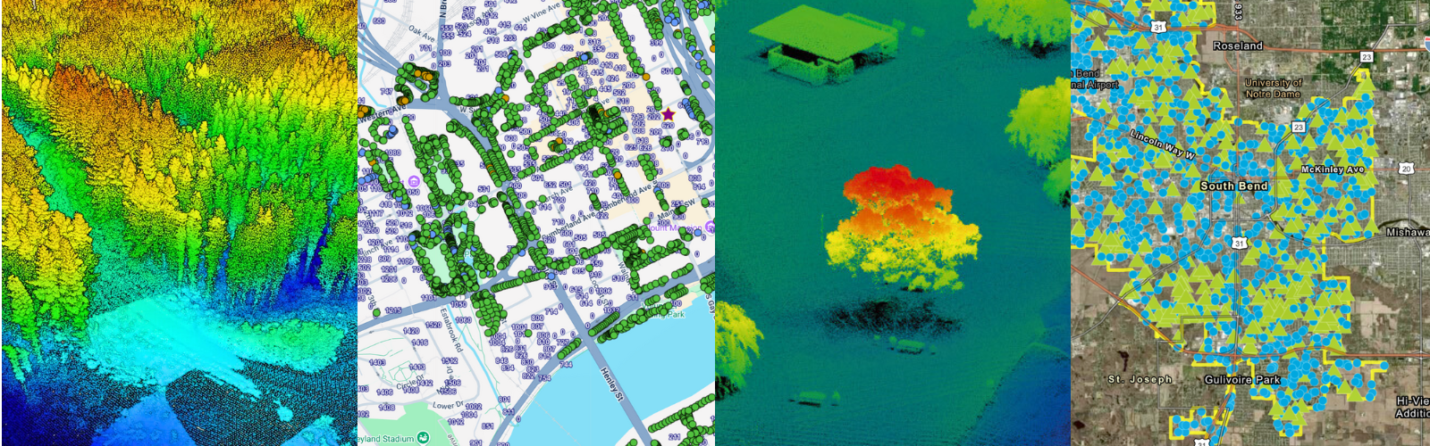
Geographic Information Systems (GIS) function as digital mapping platforms that connect location data with detailed information about trees. Picture a map where you can layer tree locations, species data, soil conditions, and maintenance history all in one place.

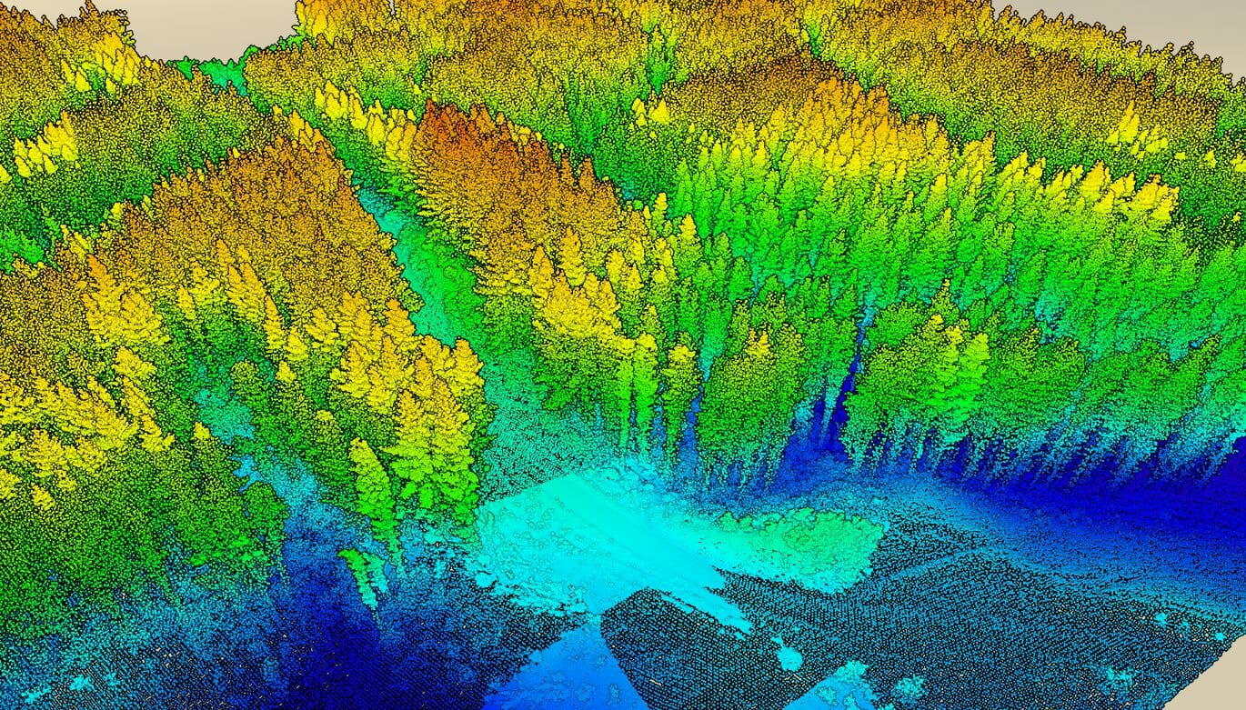
Light Detection and Ranging (LiDAR) uses laser pulses to create detailed three-dimensional measurements of landscapes. By measuring laser light reflection times, LiDAR systems capture precise tree heights, crown volumes, and structural details with millimeter accuracy.
Real-World Problem Solving
Optimizing Tree Placement and Preventing Infrastructure Conflicts
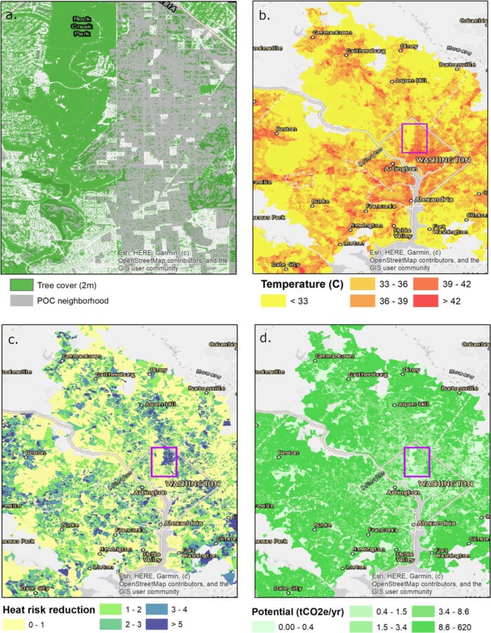
Cities face tough decisions about where to plant new trees with limited budgets, while avoiding costly infrastructure problems. GIS analysis identifies neighborhoods suffering from urban heat islands, poor air quality, or inadequate canopy coverage, with demographic overlays ensuring underserved areas get priority. The platform can also track root systems and underground utilities, preventing costly damage during construction projects.
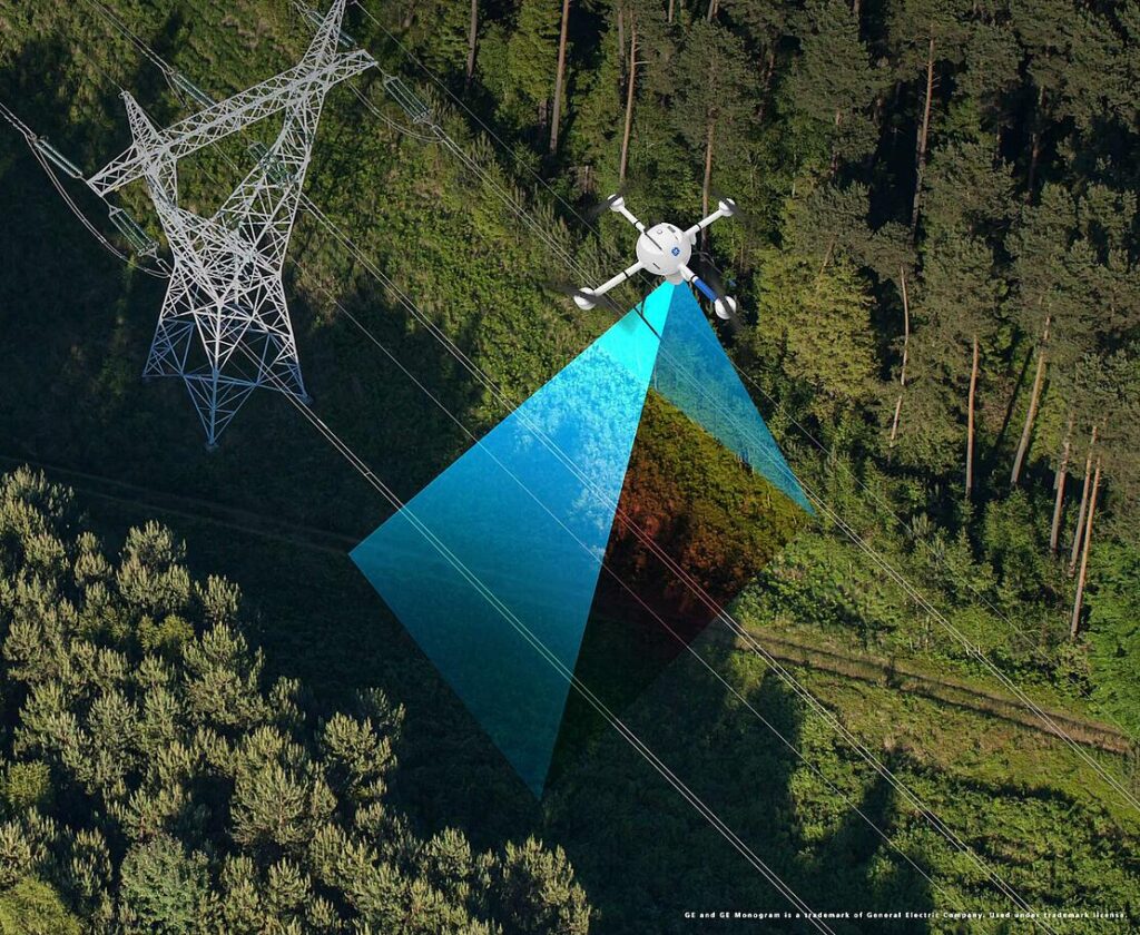
Meanwhile, LiDAR data reveals space constraints, overhead clearances, and existing vegetation near power lines, helping select appropriate species and locations that prevent future conflicts. This proactive approach eliminates costly tree removal, replanting, and power outages while ensuring trees are planted where they’ll have maximum environmental and social impact.
Justifying Program Funding
City councils and budget committees want measurable results. GIS and LiDAR data quantify urban forest benefits with hard numbers. Managers can demonstrate exactly how many gallons of stormwater trees intercept, how much carbon they sequester, and which neighborhoods benefit most from cooling effects.
This data proves invaluable when competing for budget allocations or applying for grants through programs like the Federation of Canadian Municipalities’ Green Municipal Fund or Tree Canada initiatives. Numbers speak louder than general statements about trees being “good for the environment.”
Streamlining Maintenance Operations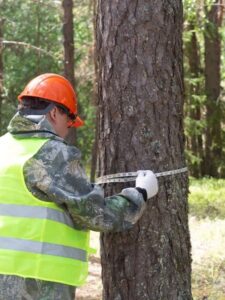
Urban forest managers often struggle with limited resources and extensive tree inventories. GIS platforms optimize maintenance routes by grouping trees needing similar care in geographic clusters. Crews can complete more work per day while reducing travel time and fuel costs.
LiDAR data helps assess tree health remotely, identifying structural issues or disease symptoms that warrant closer inspection. This targeted approach means arborists spend time on trees that actually need attention rather than conducting blanket surveys.
Implementation Realities
Cost and Accessibility
The financial barrier has dropped significantly. Cloud-based GIS platforms offer subscription models accessible to municipalities of various sizes. LiDAR data collection costs have decreased as drone technology advanced and service providers proliferated across Canada.
Many cities find that operational efficiencies offset initial investments. Reduced field time, optimized maintenance schedules, and prevented infrastructure conflicts contribute to long-term savings.
Learning Curve
Basic GIS functions for viewing and updating tree inventories can be learned relatively quickly. More advanced analysis requires additional training, with organizations like Tree Canada and the Federation of Canadian Municipalities offering specialized courses and resources in urban forestry technology.
LiDAR data processing has become increasingly automated, with software that identifies individual trees and extracts measurements with minimal user intervention.
The Bottom Line
These technologies solve real problems that urban forest managers face daily. They help stretch limited budgets further, prevent costly infrastructure conflicts, and provide the data needed to secure continued funding.
For arborists and landscape architects, GIS and LiDAR offer opportunities to demonstrate measurable impacts and elevate their practice beyond traditional maintenance to strategic planning. Once you’ve identified the optimal locations for new trees, the next challenge is ensuring they survive and thrive in challenging urban environments. This is where comprehensive tree pit systems become crucial, supporting the long-term success of strategically placed trees by providing proper root space, drainage, and structural support.
The cities adopting these planning technologies today, combined with proven infrastructure solutions, will have more resilient and effective urban forests tomorrow. The question isn’t whether these technologies are worth it, but how quickly they can be integrated to start solving problems and improving outcomes.
