
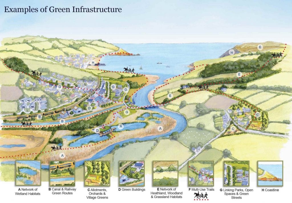
In the last decade there has been a significant rise in the number of green, or what are now being termed as “blue-green” corridors, being established in our dense urban environments in order to enhance and maintain existing habitats by connecting fragmented and isolated ecosystems.
Benedict and MacMahon (2006), in their definition of green infrastructure, suggested the need for interconnectedness of the green areas via corridors and hubs for the movement of fauna through urban landscapes. Natural areas replaced by highly developed urban surfaces originally comprised vegetated surfaces, mostly forested in the UK, and the increasingly impermeable nature of our urban areas has significantly increased the risk of flooding in our major towns and cities.
Many local authorities have integrated plans for this form of intervention as part of their green infrastructures strategies. For example, Maidstone Borough council, in their green infrastructure strategy, adopted in June 2016, details how the five rivers that run through the borough can be enhanced to provide important green-blue conduits, sustainable links to facilitate the sustainable movement of both wildlife and people. Of course, reconceptualising green blue corridors can also be integrated into urban environments to provide essential SUDs functions and enhance the way water is managed along these corridors. This will be more important than ever as many of our towns and cities, such as Sheffield and Lancaster, have river systems which have mostly been culvert and built over.

There are, of course, barriers to establishing an ambitious network of green blue corridors across the UK. In a report commissioned by DEFRA in 2004, it was noted that there was a lack of awareness of the multiple benefits of the corridor concept amongst planners in local authorities. There are also limited funds available to local authorities to implement their own schemes such green and blue interventions. A lack of understanding of the various funding and management mechanisms necessary to ensure the long-term maintenance also constitutes one of the key barriers to delivering successful, lasting schemes.
If we are to avoid the danger of these corridor schemes being purely aesthetic and ornamental, merely visible symbols of the councils general desire to provide nature in the city, but with no real strategic underpinning, we have to gain a deeper understanding of the interventions and connectivity necessary in each of our towns and cities. Producing generic toolkits to measure the connectivity and efficacy of green and blue networks, to inform decision making, is one way of moving forward and raising awareness of the potential of existing and new corridors to deliver biodiversity and climate mitigation benefits. A better understanding of the products and solutions available to increase the impact, the multi-functionality of these projects is also needed. Integrated SUDs compatible tree pits, particularly along rivers and canals, as part of green blue corridors, can be part of a more creative and innovative approach to designing schemes that make full use of the potential of both natural and constructed ecosystems.
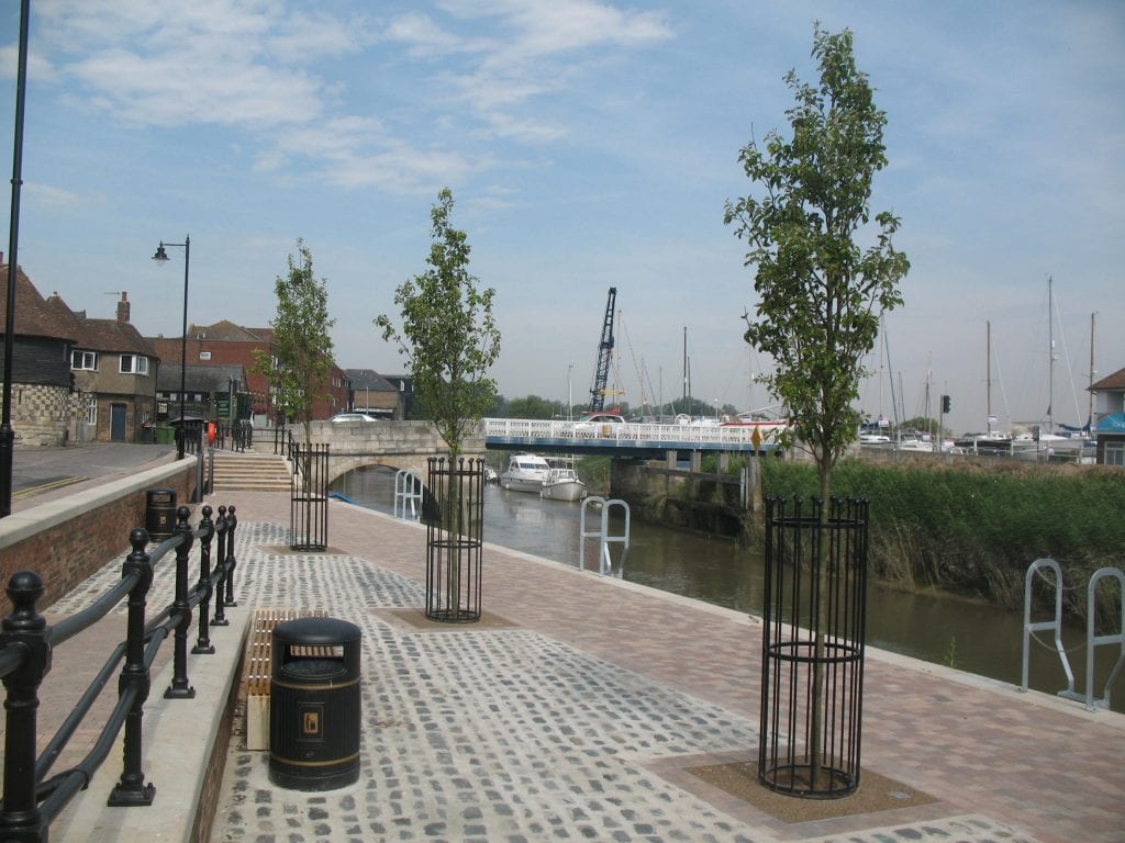
It is not always easy to achieve that fine balance between designing schemes for human use and for attaining the ecological benefits required. If we create tree-lined edges to these corridors, using solutions like RootSpace, or an integrated SUDs tree pit system such as Arborflow, not only can we protect these conduits from flooding, but we can create walkways with shading and improved air quality which can delineate between routes for humans and those for the wildlife, flora and fauna to thrive.
